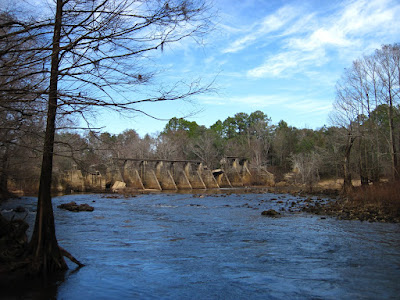
And they were great! We drove, tromped, and gazed upon various potential sites along one of the creeks. It was great to get out in the field, to see, smell, and feel what the future holds. We started at the northern end of the property, where a dam was installed many years ago. The engineers designed and installed a dam in the limestone rock. Needless to say, the dam failed. As the Calcium Carbonate dissolved over time, the dam gave way. Surprisingly, the dam was never dismantled. It remains, an anthropogenic relic cluttering up the natural environment.

The site hunting made for an enjoyable afternoon. In addition to getting a better idea of the stream riffle areas, I drove from site to site familiarizing myself with the roads on property. There was mention of mapping the stream, which would include paddling the entire stretch. The stream is off limits unless research is being conducted. The chance to paddle down it is exciting as there are class 2 rapids, which look like they would be a lot of fun!

No comments:
Post a Comment